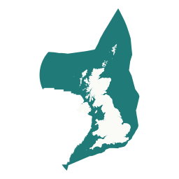
 UKCS DATA ATLAS
UKCS DATA ATLAS
UKCS DATA ATLAS
Explore and understand the marine spatial context of the UK Continental Shelf.
The UK Continental Shelf is a complex and changing marine environment. Useful information is spread across many sources, including bathymetry, offshore energy leases, petroleum licences, wells, pipelines, subsea infrastructure, cables, geology, wrecks, munitions, survey coverage, and metocean observations.
Keeping track of those sources can be difficult. Data often has to be found provider by provider, opened in separate portals, or brought into GIS before the wider context becomes clear. That makes it harder to see how marine activity, infrastructure, environmental designations, seabed conditions, and survey coverage relate to one another.
UKCS Data Atlas brings those sources into one map so they can be viewed, compared, searched, queried, and exported more easily. It combines more than 90 reference layers with specialist spatial tools and selected live offshore context.
Reference datasets are designed for periodic refresh, with weekly update checks and source currency shown where available. Original provider links remain the authoritative source.
Live helicopter coverage depends on volunteer ADS-B receivers and aircraft altitude, so positions can become intermittent offshore. Estimated or signal-lost positions are clearly distinguished from confirmed live reports.
Live vessel positions come from AISStream.io and cover Western Europe. Static details such as name, type, and dimensions arrive separately from position reports, so the tracker remembers the most complete particulars received and the information shown can improve over time.
Signed-in users can save areas of interest, revisit previous searches, and subscribe to changes from selected data providers globally or around a saved area.
UKCS Data Atlas was created and is independently maintained by pyramid146. It is an independent project built to make UKCS open data easier to discover, compare, and understand together.
The atlas provides marine spatial context and general awareness. It is not intended for navigation, operational safety, legal boundary determination, or statutory advice. Source data remains subject to the original provider licences and attribution requirements; KIS-ORCA layers should be checked against the official KIS-ORCA downloads and terms.
Suggestions are welcome, especially for open datasets that would add useful UKCS marine spatial context.